
I just got back from a great two-day conference at the Virginia Military Institute, Ethical Dilemmas in the Digital Age, and my mind is reeling a bit, so I’m sharing initial thoughts/notes so I can…
Browsing Category Technology
Goodbye, IDX
IDX. Internet Data Exchange. For those not actively involved in real estate, that means (pretty much) “showing homes for sale on a broker website.” Now, I recommend searching for homes in Charlottesville at the Nest Realty…

Trying out a Matterport in Charlottesville
I’m trying something new; while I’m not the first in Charlottesville to try marketing a house via Matterport, I’m one of the first. Sometimes cutting edge is better than bleeding edge.
Thoughts on this Matterport walkthrough welcomed. The house is not quite ready for the market*, but will be soon. I’m not sold on the “dollhouse” view, but the walkthrough of the house definitely shows the layout. I thought the Matterport would be useful for this particular house as the layout is quite diverse. I like how you can see out the windows as well.

What is this House’s Operating System?
“Is your home updated with the most recent security patches?” Will that soon be part of a home buyer’s due diligence? I already ask for utility information (cost, providers, etc) Googling a property address is…
Photosphere and Hyperlapse – Two Interesting Tools
Google have released a new tool that further enables users (us) to help them map the world. Photosphere was just released for the iPhone (it’s been available on Android for a while) and it’s quite remarkable. I’m not sure just how useful it is, but it’s mighty interesting. Photosphere will certainly help me detail for my out of town/country clients, but I don’t know if it’s any better than video, despite the higher resolution.
Curious? This is a photosphere I took of the new Lochlyn Hill neighborhood, currently under construction.
Hyperlapse by Instagram/Facebook is different, exciting – and differently useful. In comparison to the static, 360º images provided by the Photosphere app, Hyperlapse has been described as “a $15,000 Video Setup in Your Hand.” I see great potential for Hyperlapse for telling stories – the stories that make a city, an area, a neighborhood, a street – compelling.
Interesting times, and with the new iPhones being released with seemingly infinitely more powerful processors, I think we’ll be seeing an a lot more Hyperlapses and Photospheres.
An example – Downtown Crozet is in the midst of Streetscaping right now …
Instagramming More than a Flyover
I’m working with some folks now who are contemplating from afar a move to Charlottesville. Years ago, I would go out and take pictures of their As part of their process, they’re doing “flyovers” in Google and Bing to get a better sense of the area (as many buyers are wont to do). But … these respective Street Views don’t offer the flavor of an area … But Instagram does.
Check out “The Beat, a new project from the Rutgers Social Media Information Lab” … better yet, see if you can get a sense of Charlottesville from The Beat.
As the commenter at The Atlantic says, if the geolocation of the Instagram photos gets more accurate, this would be truly, truly useful.
Update 6 December 2012: This post is already outdated, as I suspect that Instagram will be less useful now that Instagram (Facebook) have decided to “prevent its images from showing properly on Twitter’s website and clients” – as I said on G+, The silo-ing of social media is distressing. and leads me to invest less and less in these channels. I so wish Flickr hadn’t failed on mobile so miserably.
C’Mon, Apple. Real Estate Agents Need Property Boundaries
How will I show land without parcel boundaries on my phone?!
There’s been a lot of discussion about the new Apple maps, which will be replacing Google maps on the next iPhone.
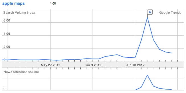
This isn’t enough to switch back to an Android device from my iPhone 4S, but it’s significant. In the nearly-three-years since Google integrated Albemarle County’s property boundaries as one of its layers, I’ve become quite dependent on this extremely useful feature.
Gizmodo did a nice side-by-side comparison of Google Maps vs Apple Maps, but they left out one thing that I use in my real estate practice multiple times a week – real estate parcels.
I saw some discussion about it last week in my Twitter stream, and asked for some help on Google+
Anyone with access to iOS 6 – can you tell me if the new apple maps have parcel boundaries as the google maps do? I need and use those to show property – in subdivisions and when showing raw land.
And thankfully got an answer pretty quickly from a friend.
Note the difference between these two photos? iOS5 has property parcel boundaries, while iOS6 doesn’t.
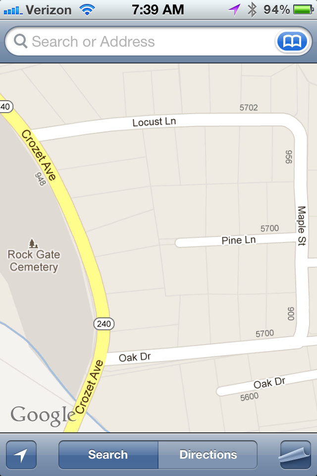
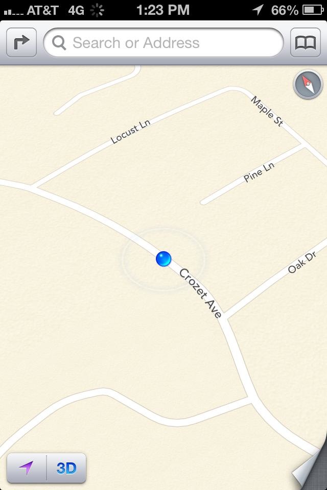
While I wouldn’t advise my client to accept these boundaries in lieu of a survey, they are usually accurate enough when walking land or lots, particularly when walking county/country properties where “natural” boundaries such as power or telephone poles aren’t visible.