“Will I fit in†this neighborhood? – I’ve mentioned this twice in the past two years – once this year and once last year (and probably a time or two before in the past nearly eight years of writing here). Enter Sitegeist – a new app from the Sunlight Foundation.
What is it? Just a lot of what buyers are interested in when evaluating where to live (particularly when relocating to a new location). Now, in addition to telling buyer clients that I can’t tell them if there are kids in a neighborhood, that they should visit a location multiple times at various times before making an offer … download Sitegeist.
I’m going to be testing the app over the next few days to verify its accuracy. After a few initial tests it seems pretty accurate – albeit a bit broad – it doesn’t seem to (at least in Crozet) pull neighborhood data, but zip code. (so far in my test)
From their site:
Sitegeist is a mobile application that helps you to learn more about your surroundings in seconds. Drawing on publicly available information, the app presents solid data in a simple at-a-glance format to help you tap into the pulse of your location. From demographics about people and housing to the latest popular spots or weather, Sitegeist presents localized information visually so you can get back to enjoying the neighborhood. The application draws on free APIs such as the U.S. Census, Yelp! and others to showcase what’s possible with access to data.
And …
Some of the data you’ll learn about a location includes:
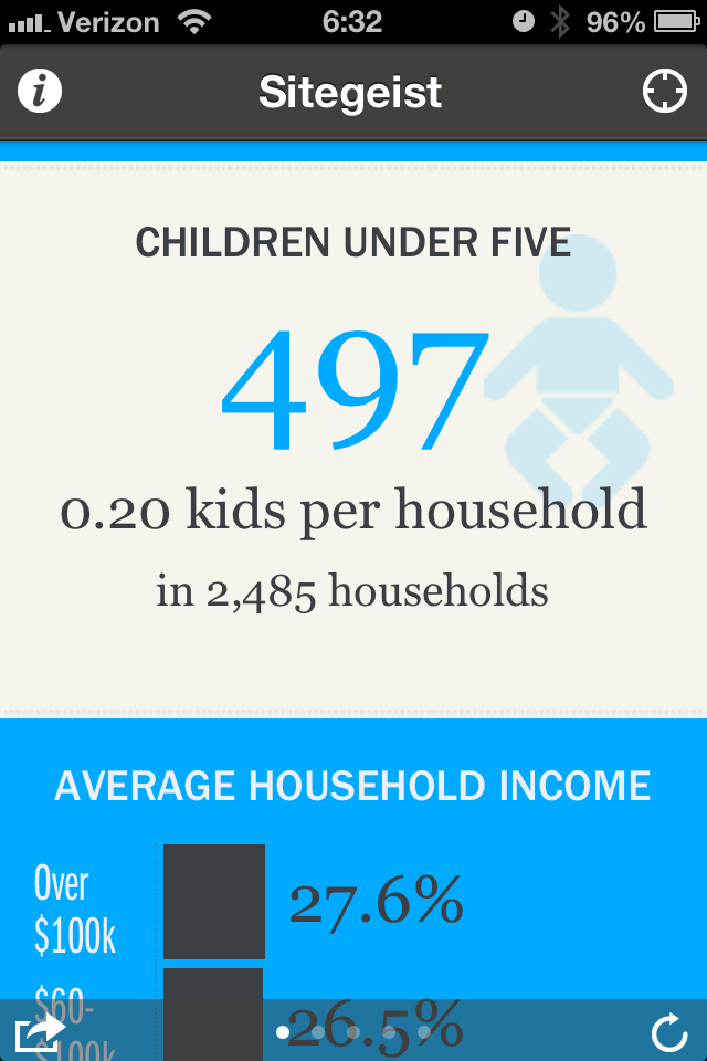
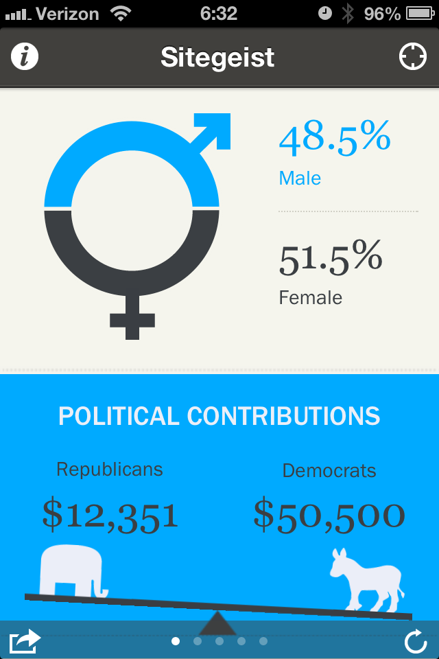
• Age Distribution
• Political Contributions
• Average Rent
• Popular Local Spots
• Recommended Restaurants
• How People Commute
• Record Temperatures
• Housing Units Over Time
Fascinating.
Update 3 January 2012: I asked them on Facebook:
“How localized is the data? Zip code? Is there a way to specify a radius?â€
Average rent is data collected by the US Census and is based on 2010 data for each census tract.
Each of the various data sources we use have slightly different geographic areas:
- Census uses census tracts
- Political contributions use ZIP codes
- Everything else is based on a relevant geographic radius from the current location
We wanted to simplify the user experience by not bombarding folks with a bunch of geo errata, but this is something we’ve heard from a lot of people. We’ll be looking into ways to provide this information in a uncluttered, easy to understand way.
Thanks for your feedback and for using Sitegeist!
So … it’s good for very general information, but notosmuch for neighborhood information.